It was decided long ago that when we will go to Ladakh, we would do it by the driving on the spectacular Manali-Leh Highway. Our dear friend Indranil da, who is an expert in organizing tours in Ladakh, suggested that we add Tso Moriri to this road trip to which we readily agreed and decided to take our night halts at Keylong, Sarchu and Korzok before reaching Leh. At the end, it turned out to be perhaps one of the most beautiful road trips that we will ever do. There is a popular saying that it is not the destination, but the journey to get there – the Manali-Leh highway is the embodiment of this saying. So after 4 long months of waiting and looking forward, on a hot and humid Kolkata evening in the month of June, five of us started from Sealdah station in Kolkata.
Day 1 : New Delhi and the Bus to Manali
Our train reached New Delhi station around 10 in the morning and we checked into a small hotel in the bustling Paharpur area near the station. Our bus for Manali will be leaving from Kashmiri Gate at 5pm and we needed just a short layover to refresh and have lunch. My friend Ronit came over and we had lunch at the American Diner located inside the Habitat Center complex. Went back to the hotel and rested for a while before commencing the overnight journey to Manali by bus. We were fast asleep when late in the night we could feel the sharp turns the bus has started taking, which meant we are on the hills, a thought which brought instant happiness.
Day 2 : At Manali
We reached Manali (6725 ft) bus stop at 6 in the morning. Being an air-conditioned vehicle we did not feel the change in temperature until we got down from the bus. From the scorching Delhi heat of 42 degree centigrade to a pleasant 17 degree was very pleasing. But we knew in the coming days it was going to get much colder.
(A note of caution – reaching Manali early morning opens up the option to proceed to Keylong on the same day. But this not advisable. A day’s rest at Manali is recommended for proper altitude acclimatization)
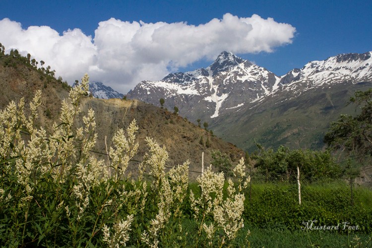
The Kullu valley greeted us as we left the bus stand. The car crossed the turquoise green Beas river and turned right towards Jagatsukh. Few km after, we dropped our luggage at a quiet and charming guesthouse run by a local family and gave ourselves a little rest in our rooms which provided lovely views of the valley. The stiff necks that we acquired from the overnight bus journey quickly dispersed with the cool mountain winds. Re-energized after a sumptuous breakfast and a quick bath we set out for a little sightseeing – our destination being Vashist.
Situated 2 km north of Manali, the village of Vashist is a chilled out place and is a compact version of old Manali. It is an amorphous jumble of traditional timber houses, divided by paved courtyards and narrow lanes. The atmosphere is traditional and tranquil (only disrupted by few rave parties, but that take place out in the woods). We visited the two old stone temples at the main square dedicated to the local patron saint Vashist, one of which houses a hot spring. Then we took a walk around the charming village with colourful houses and people dressed in the traditional Himachali dress.
Shortly after the sunset we went back to the guest house followed by an evening of chit chats followed by some serious shouting at the television during the football world cup final match.
Day 3 : Manali to Keylong
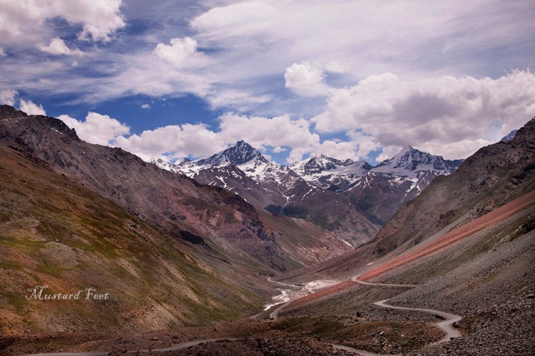
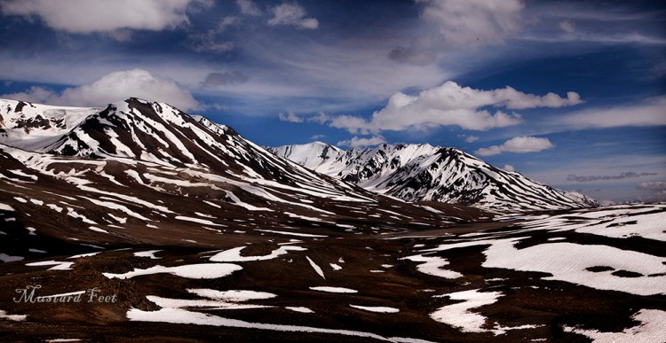
The great 500 km journey on Manali-Leh highway via Tso Moriri awaits us. We started for Keylong at 8 in the morning. It is important to start early as Rohtang La tends to get quite crowded with tourists. The Beas river left us at Palchan, where we turned north. Slowly the greens of Kullu Valley transformed to a snowy affair of the Shivalik mountain range and the tall trees gave way to smaller vegetation. We were happy that traffic was negligible and would not have to face the notorious log jam of Rohtang La. The roads became serpentine and we were gaining height steadily. After climbing some hairpin bends, the mountain walls opened up and we were at Rohtang La. Situated at 13055 ft, Rohtang pass was cold with an icy breeze blowing on our face. There ground was moist with scattreted snow and a few tourists. The Shivaliks looked great across the valley before the scene turned foggy and we went to one of the make shift shops and added some warmth with a cup of tea and maggi.
From Rohtang La, the car climbed down to Gramphu where the road from Spiti Valley met the Manal-Leh highway. The mountains on both sides were coated with a layer of green grass and the Chenab river or Chandra as it is locally called, greeted us near Khoksar and brought sunshine and open sky with her. We had to register ourselves at the Khoksar check point before proceeding. We were now travelling through a small valley with the peak of Hanuman Tibba standing tall on our left. This is the land of God Geypan, who is worshipped in this valley. The road became narrow and dusty but we were comfortably driving ahead. The newly sowed green farmlands looked positively greener against a backdrop of rocky mountains.
The Chenab or Chandra River left us at Tandi (10,100 ft) where the Bhagha river joined her. This Bhagha river took the place of her sister river Chandra and started accompanying us as we turned north from Tandi. An interesting fact is that Chandra and Bhagha both originate from the same place – Baralacha La, but from diferent face of the mountain. While Chandra flows east before turning west, the Bhagha flows south through Keylong. They are like long lost sisters who meet finally at Tandi.
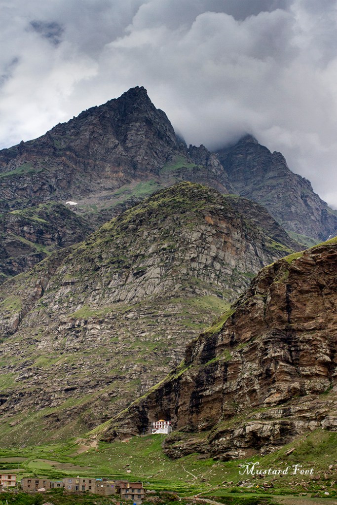
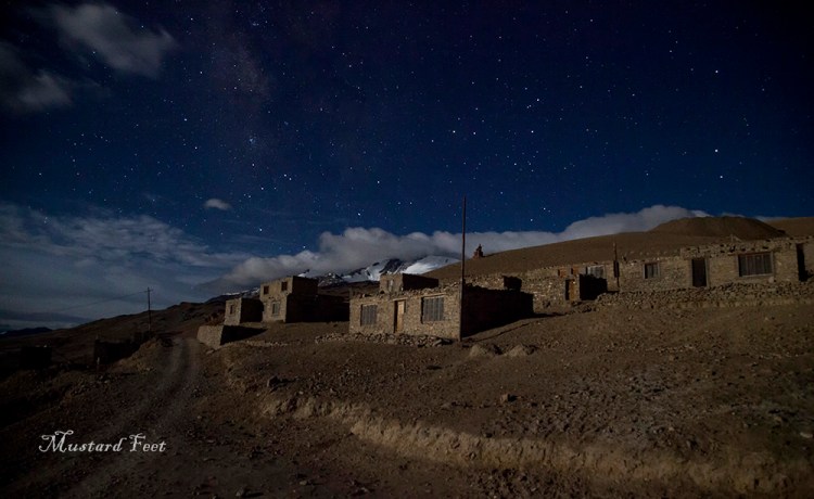
At Tandi be sure to fill up your vehicle tanks as the next petrol pump wold be at a distance of 365 km. We reached the small and beautiful town of Keylong (10105 ft) in the late afternoon. The view from our guesthouse was beautiful with a peak at both sides. We went for a small walk-around the bus stand, spent our time on the roof under a star lit sky and retired for the night after dinner.
Day 4 : Keylong to Sarchu
The Bhaga river flowed playfully below us, as we started from Keylong towards Sarchu, our next stop on the Manali-Leh highway. Soon we were driving through the picturesque valleys of Jispa and Darcha. The road from Keylong has climbed steadily and then at Jispa it lowered down to the river valley. The deep blue sky looked unreal and the magnanimous mountains decorated the horizon.
We crossed the Jispa village (10,500 ft). The landscape began to change. The mountains loomed large everywhere, their peeks now seemed to be at touching distance. The greens have faded but there were colours everywhere – the raw colours of the earth in multiple shades. We could clearly understand why the scenery of this route is so talked about. Shortly after Jispa we reached Darcha village (11,025 ft) which was the last village served by the Himachal Pradesh state bus.
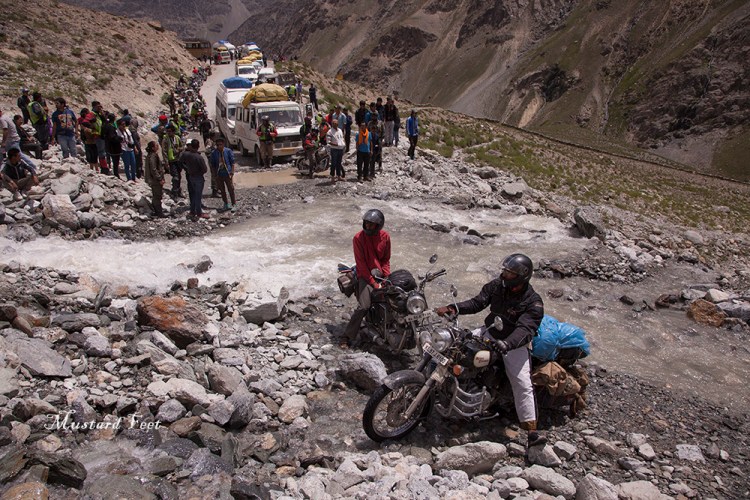
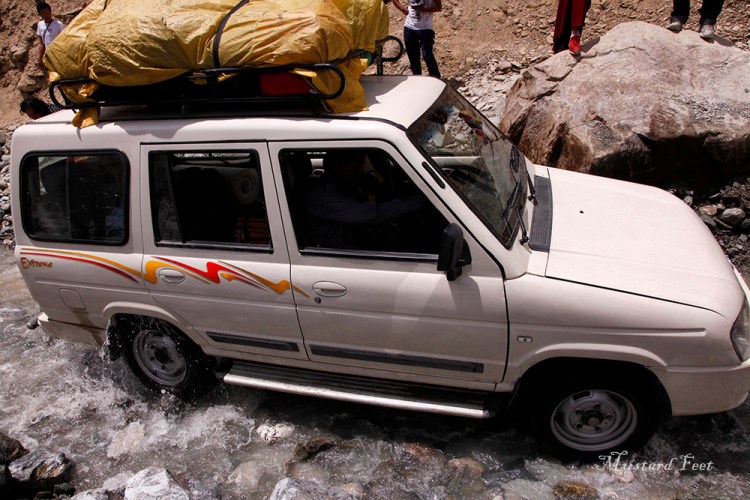
Our steady progress came to a sudden halt at Pagal Nalah (mad stream). It was a water stream cutting across our way and it was at full flow. There was long queque of cars at both end as drivers carefully crossed the gushing stream. There was no road around the stream bed but only slippery rocks which made the crossing difficult and dangerous. We got off from the car and crossed the stream a little up the valley from the road where the width of stream was negotiable. We then walked till Deepak Taal and waited for our car at an adjoining tea stall. It took our car almost two hours to cross the Pagal Nalah and then we again started towards Baralacha La.
One more short break was taken at a mechanic shop located opposite to Zing Zang Bar. A quick but necessary check up of the car was done before we started our climb to the Baralacha Pass (16050 ft).
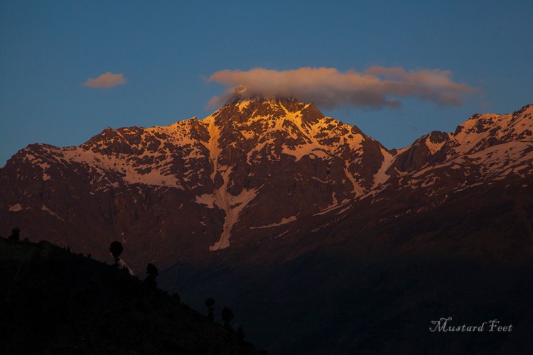
After negotiating quite a number of hairpin bends, our car stopped at Baralacha La. We were blown away by the scene. We stood shivering against the gutsy wind blowing along the valley but could not walk away. A magnificent pallet was laid before us, decorated with snow and earth, garnished with the colourful prayer flags fluttering against the raw beauty. We were sure that no photograph or video will do justice to the experience we were having. The Suraj Taal (Suraj Lake – lake of the sun god), nestled among the mountain ridges added to the beauty of Baralacha La.
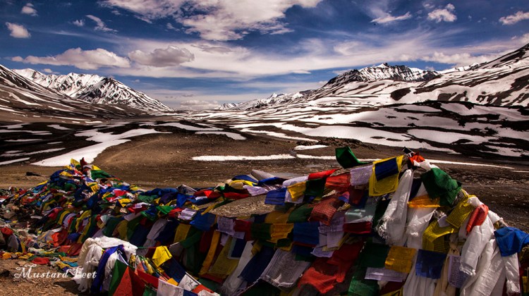
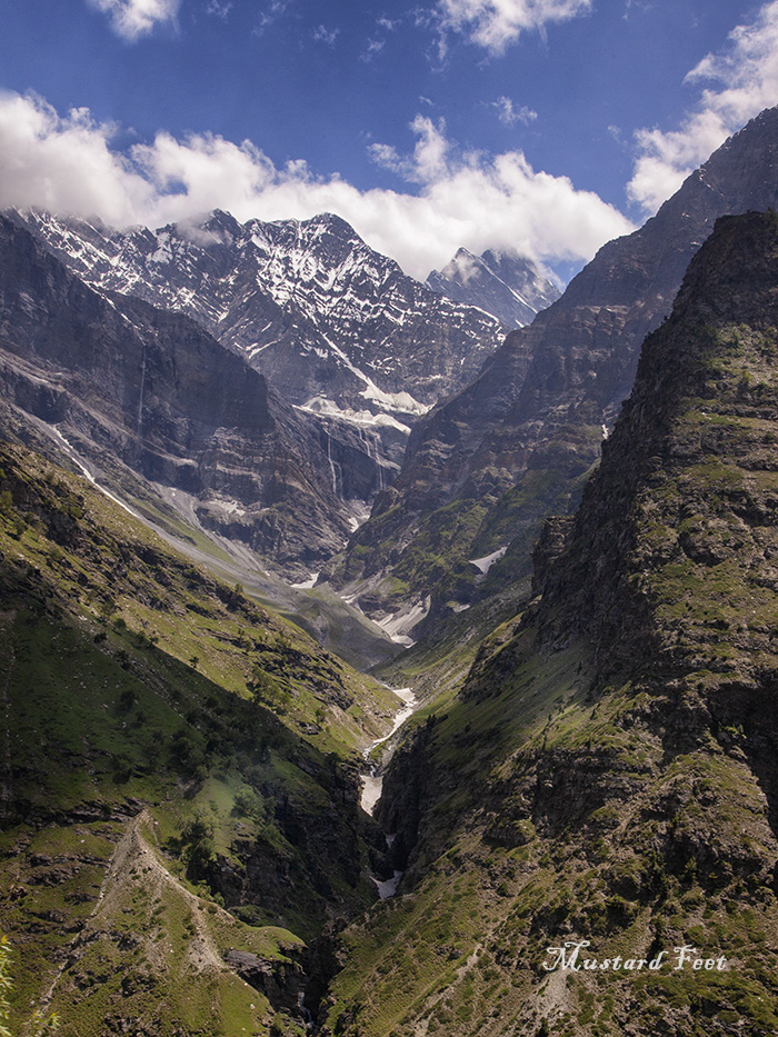
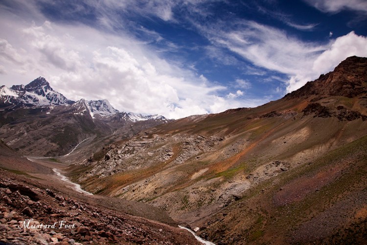
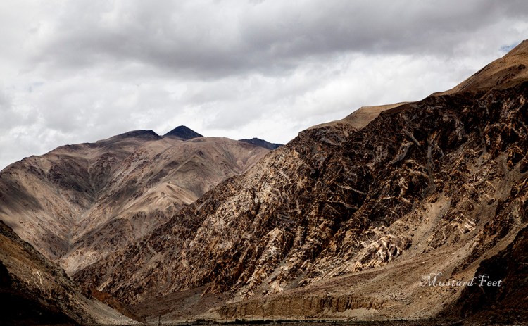
Due to high altitude of 16,050 ft be easy on your movements here. Walk around slowly. After 15-20 minutes we decided to bid adieu to this beautiful place. Our road meandered through a wide valley with the Zanskar range towering above us and crossed over to the Jammu & Kashmir district from Himachal Pradesh. We crossed another broad stream of water flowing across the road and descended into the Bharatpur valley. The calm and quiet Tsarap river now joined us. The vista was amazing. With barren mountains glowing in sunlight, the landscape was something we have never seen before.
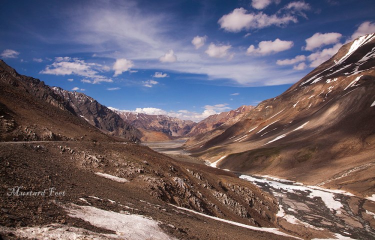
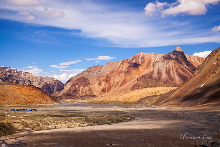
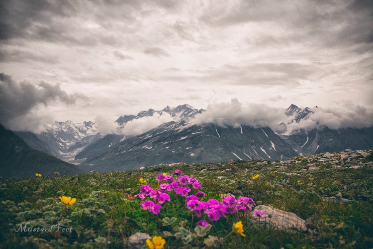
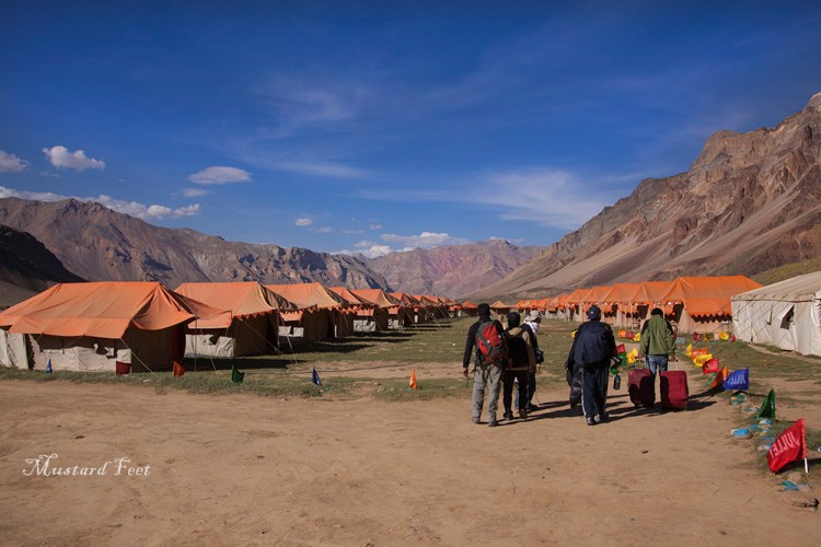
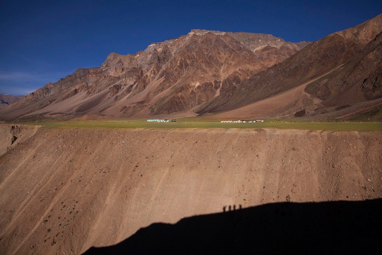
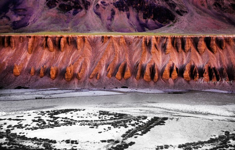
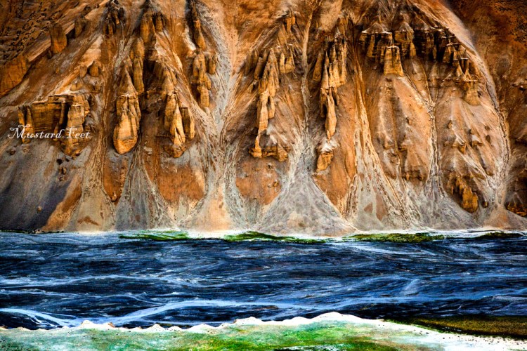
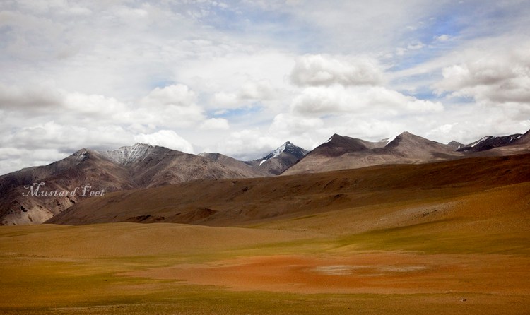
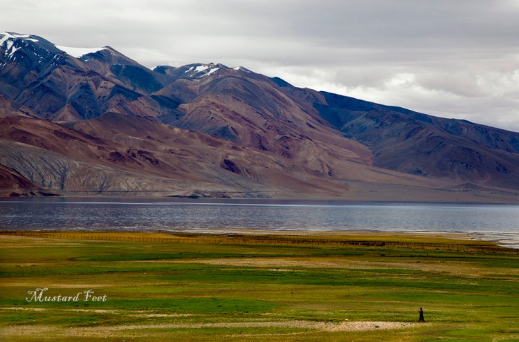
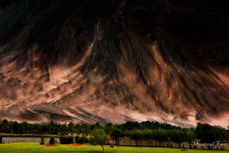
And then towards the end of the day we came to a green flatland called Sarchu (14,070 ft). Sarchu seemed to us as a small green field amidst the earthy mountains. It was actually a high altitude plateau. Being a plain land, the road here seemed like an expressway after all those ups and downs. The vast field at Sarchu has several tented accommodations one of which served as our night halt. The Tsarap river flowing below in a tight valley and we along with the green field we stood on was surrounded with mountains. As we walked up to the ledge of the river valley we noticed that years of wind erosion have created very interesting rock formation along the river banks. Another interesting find was the mountain slopes having a purplish hue on other side of the river, probably due to manganese deposit. And all these was beneath an unreal solid blue sky which is only seen to be believed.
In Sarchu we made a mistake. Before the tall mountain ridges behind us took away the light, we jogged for a distance to reach a vantage point to take some photographs. We panted, grasped for breath and when we came back we had headache. The lesson learnt was to never hurry at such high altitude. We drank garlic soup. Appetite was a stranger that night and we went to sleep early. It was a cold night and wasn’t a comfortable one either.
Day 5 : Sarchu to Tsomoriri
The next morning the headache and the sun both vanished. It was foggy with a cold wind blowing across the open valley of Sarchu. We wanted to stretch our legs before a long journey to Korzok Vikkage on the banks of Tso Moriri ( Lake Moriri), but a light drizzle started and we had no other option but to get on with our journey.
After a short while came the climb of 21 hairpin bends, called the Gaata Loops. It was a difficult part of the road and on top of it, we were faced with a wet road. As we climbed the loops came into view below. In less than an hour’s time, the loops elevated us by a height of 1500 ft.
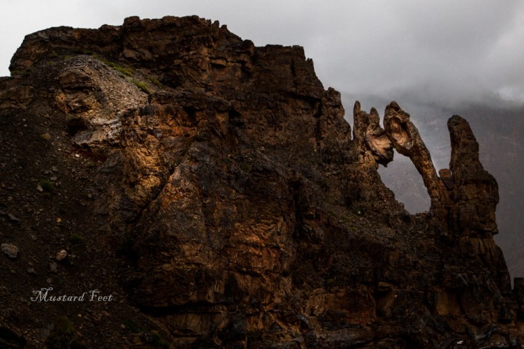
As we were at the end of our climb, clouds surrounded us. Our driver was hot happy to loose visibility on this part of the road. None of us spoke for a while. The silence was deafening with our vision being obscured. After sometime we made to the top of the loop and reached Nakee La (Nakee pass), situated at 15,500 ft and then descended again onto a dry plain only to climb up again to cross Lachung La (Lachung pass) at 16,600 ft. The cloud and short drizzle was on and we did not stop at Lachung La. However a beautiful piece of natures’s art came into view here. It looked like two faces kissing each other. It was beautiful.
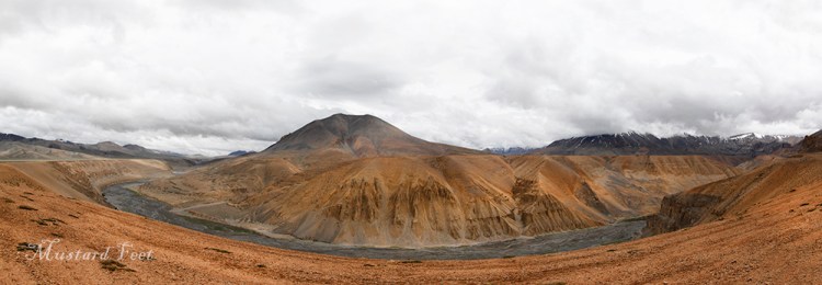
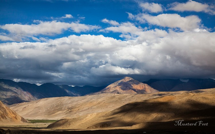
We were getting depressed with the weather. Everything was under cloud cover and we were just driving ahead in bleakness. And then when we stopped at Pang (15,100 ft) it cleared up for a while presenting us with yet another amazing sight. The panoramic view of the Pang gorge and the surroundings was a treat for the eyes.
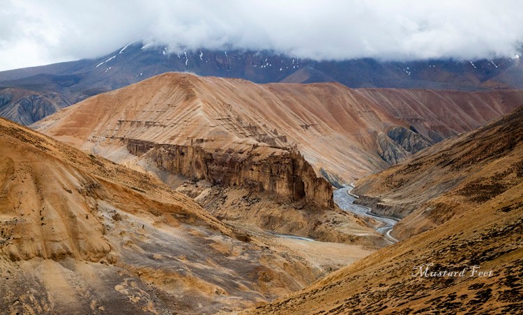
As we stood admiring the view, small gaps opened up in the cloud blanket above us and sunbeams dappled the valley creating a magical light and shade playground. A vast stretch horizontal land ran all the way back to the horizon where it sloped up into beautiful rolling mountains. Beside this plain land, the small stream of Kangla Jal flowed on a colourful rocky bed – as if trying to infuse life into this beautiful barren landscape. We took a small walk and stretched our legs. Walking in this vast openness is an experience by itself. You realize how minuscule you are in comparison to nature.
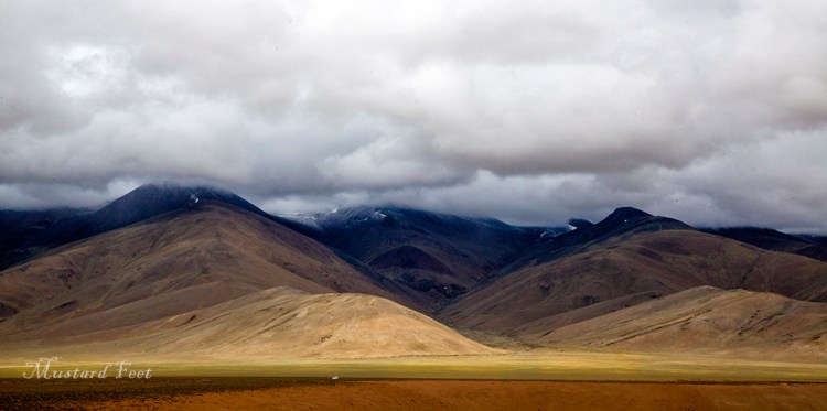
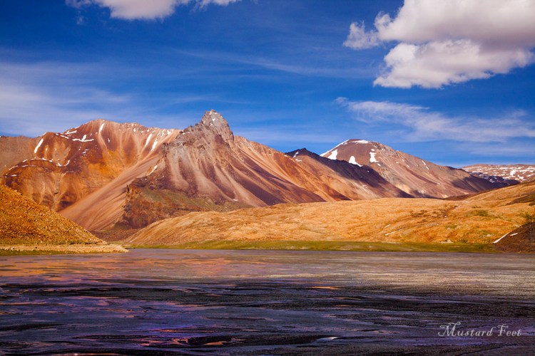
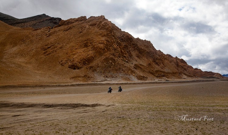
When we eventually restarted the clouds have filled those gaps again in the sky. The road cut through a wide plain and few km ahead we suddenly took a right onto a dirt track – towards Tso Moriri. After a while we realized there was actually no road and we were driving on a dusty field with mountains on both sides. Everything around us was just brown and there was sign of any life form. This part was perhaps the most desolate area we drove while going from Manali to Leh. The jumpy ride continued for a while. We could see the Tso Kar glittering down in the valley below. Half and hour later our car jumped onto a proper tarmac and we turned right. We have now entered the cold dessert area of Changthang (eastern flatlands). The road was almost flat and we swiftly moved forward through the Puga Valley. We saw smoke emitting from few places down the plain lands. We learnt that Puga was a geothermal field of natural Sulphur mind and those smokes were coming from underground hot sulphur springs.
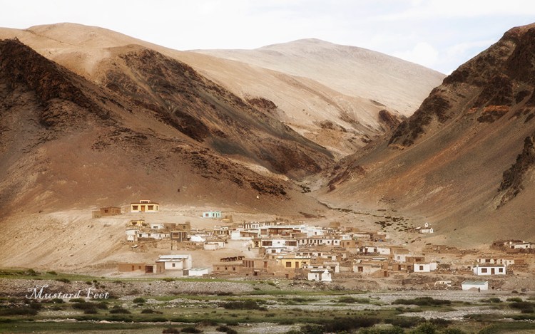
The village of Sumdo suddenly came up out of nowhere. We were surprised to see a village in an isolated place like this. At first the village looked abadoned, but as we went close we could see quite a number of people. Actually only a 10 km drive towards north from Sumdo would land you on the banks of Indus and from there the route to Leh through Chumathang has several villages.
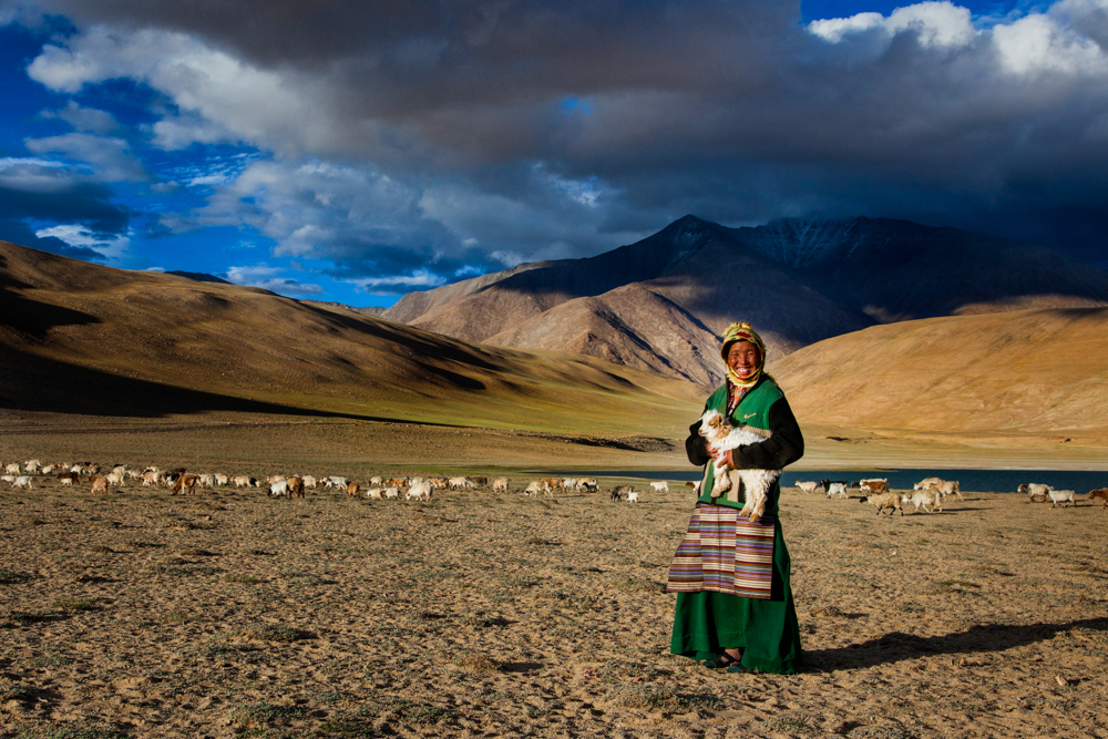
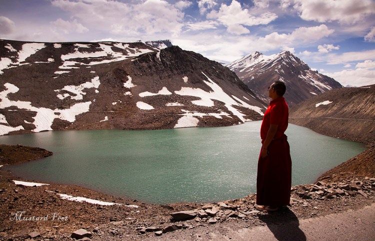
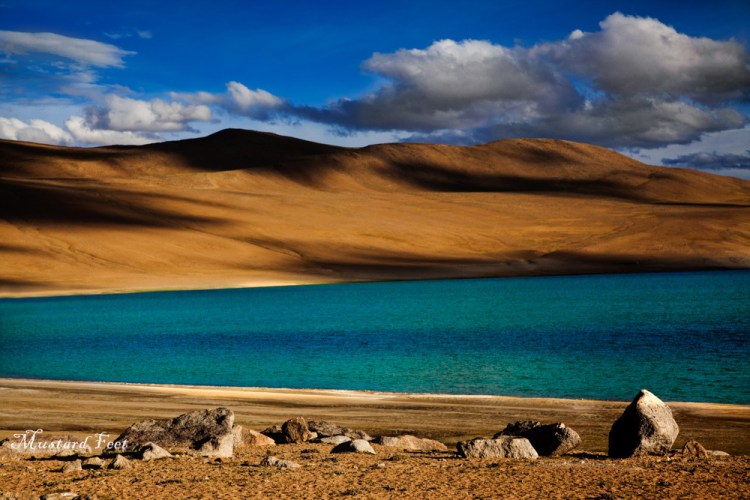
We decided to visit the village on our way back and from Sumdo we turned east. The road turned dusty again. We were very eager to see Tso Moriri, but suddenly the magnificent Tso Kyagar (lake Kyagar) crept into view. The view simply bowled us. The clear blue lake separated from an equally blue sky by a band of golden mountains and snow peaks. On the lake shore, under the golden light few shepherds were roaming around along with their fleet of sheep. As we got down from our car, a lady shepard greeted us with happy face – “juley!”, meaning hello in ladakhi dialect. She was standing there with a baby sheep in her arms, against the backdrop of mountains and blue sky, smiling and greeting us with a genuine warmth which added happiness to this beautiful place.

The light started to fade and it was another 25 km dusty ride to Korzok village, situated on the shores of Tso Moriri. As we neared Tso Moriri we were stopped at a checkpoint. Few years back an inner line permit was required to visit this lake, but it has been withdrawn now. However, we were told by the army men that few days back two people have disappeared after staying at Korzok village, and thus currently they are monitoring all movements to and from Tso Moriri. We showed our IDs, the army men wished us a good stay and we moved forward.
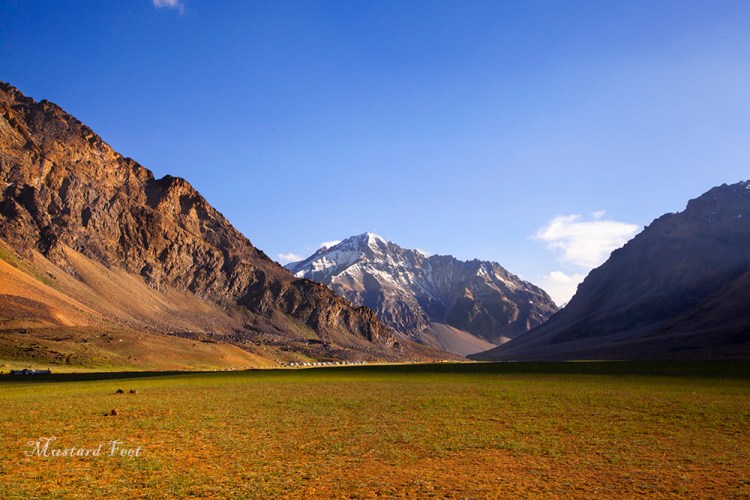
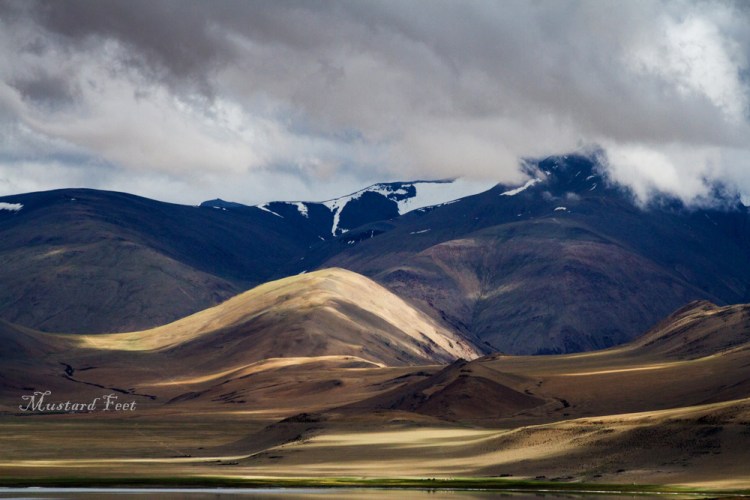
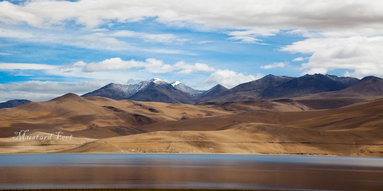
The first sight of the Tso Moriri was a magical one. We awed at the beauty with naked eyes for a couple of minutes before we realized that the cameras were lying idle. The green shore line, an azure blue water band of Tso Moriri, light and shadow playing hide and seek on the slopes of the golden mountains that stood guard at the horizon and the amber clouds decorating the blue evening sky. It was magical.
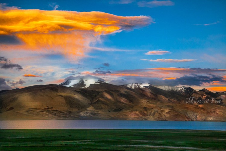
The narrow road hung onto the shoreline until we reached Korzok village (15,075 ft) under the last lights of that day. The surrounding looked mystical with the ghostly stone houses of Korzok village scattered all around and the mountains trying to cling onto the vanishing light of the twilight.
After the tents in Sarchu, the spacious guesthouse felt extra comfortable. The night was cold and dark. Five of us gathered in a room and chatted away late into the night.
Day 6 : Tsomoriri to Leh
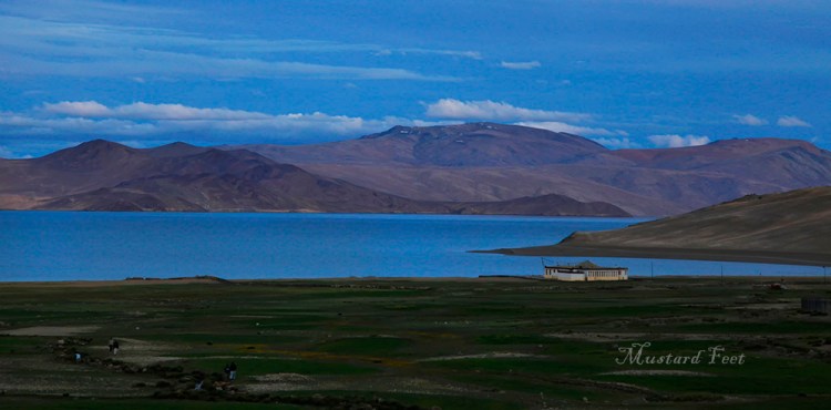
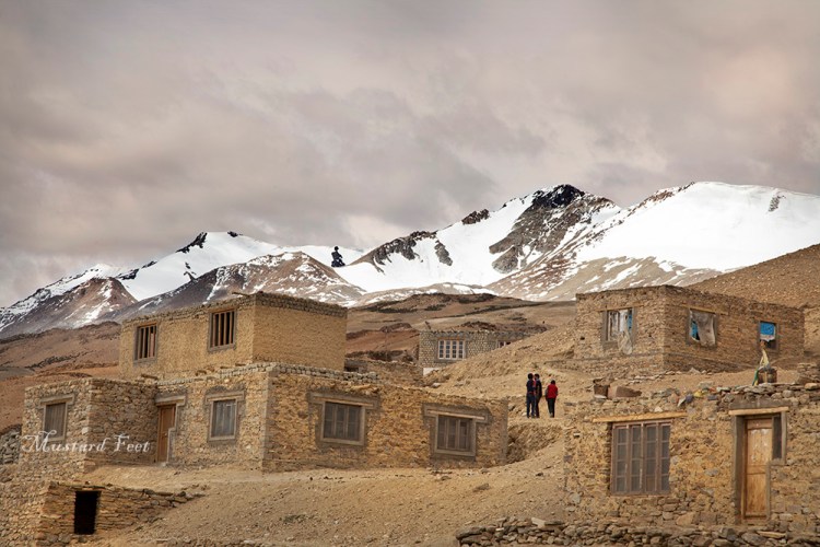
Korzok village looked like a set straight out from a movie set. The village sat on the high shore banks of Tso Moriri. The cluster of stone houses with their unfinished outlook looked very interesting. Behind the village we could see the beautiful lake, glowing in the soft morning light. On the other side, the white Buddhist stupas dotted a gentle mountain slope.
We roamed around the village for an hour, with an occasional “juley” greeting us in the narrow lanes and by-lanes. We patted an yak, saw a small sheep farm, was invited for tea by a local guy, tried to converse with some young boys, gazed at the lake at the end of the village. It was a lovely morning.
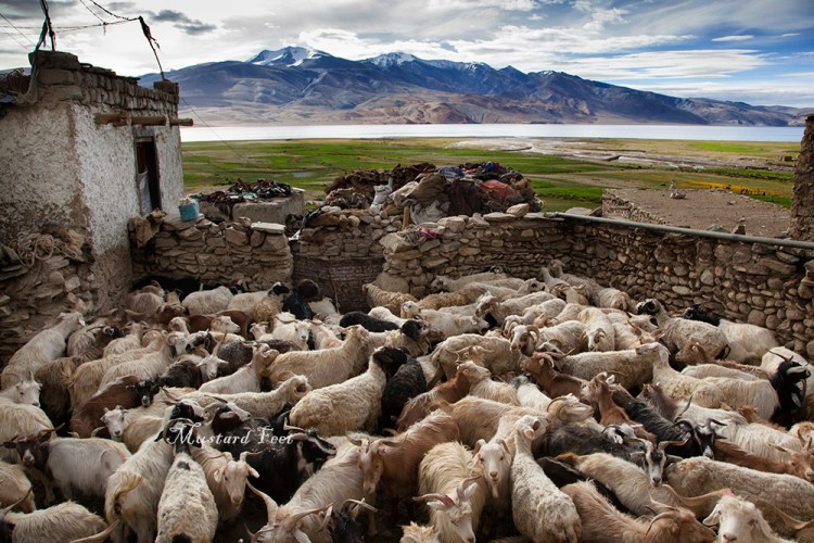
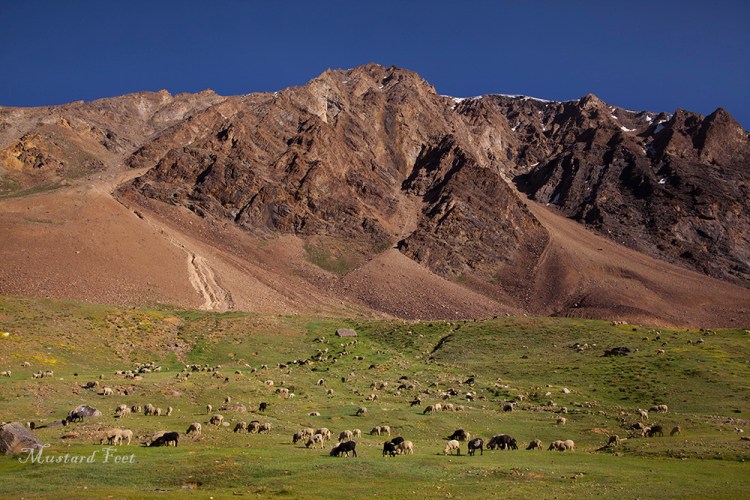
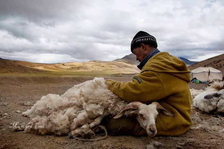
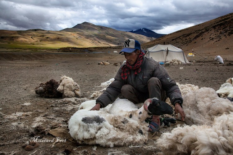
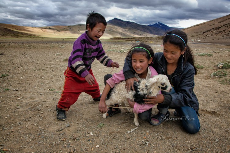
After breakfast, we began the final leg of our journey to Leh. We left Tso Moriri and drove past the Tso Kyagar, its water like a blue canvas. As mentioned earlier this area falls under changthang valley – a high altitude vast plateau extending from western Tibet to the south-eastern Ladakh region. This region is the home to the changpas – nomadic pastoralists. The livelihood of this nomadic people depends largely on the livestock like sheep and yaks and they move from one pastures to another on this changthang highlands depending on the season, to find plants for their animals to graze on. Korzok village was actually a seasonal hamlet for the changpas before it turned into a village. Sheep’s wool is a very precious resource for them in terms of trade – and we came across such a changpa community on our way back from Korzok. On a vast plain, encompassed by mountains, the men were busy shearing sheep. Shearing is the process of taking out the woolen fleece off a sheep. It looked cruel. But as we watched we understood the process is not painful, it was as if the sheep is getting a haircut. The men were expert in this – we could not see a scratch or blood on any of the sheep that had been sheared. It was the main livelihood of these changpas. At a distance there were few small tents, much like the ones used by trekkers. There were children, women and a dog. Among such hardship they greeted us grinning. We realized how easy it is to smile.
Half an hour later we met the road by which we came from Tso Kar and there stopped at Sumdo village. The stone houses similar to Korzok village basked under a hot noon sun. We found most of the people have left for work and only elders and children were present at that time. Once we walked in, we found out it to be a fully functional village and even had a small school. But life here is tough and hard. Our conversation was limited to the “juley” word only, later our driver helped out a bit as a translator.
From Sumdo we travelled north and reached Mahe bridge (13,600 ft) – a metallic bridge over the Indus river. If you turn east after crossing the bridge the road eventually takes you to the famous Pangong Tso (Pangong Lake). This was our original intention but we decided otherwise because our fuel in the car was limited. Thus we turned west from the bridge and followed along the Indus river towards Leh, another 150 km through the Indus valley. The road and the river hung onto each other like newly weds, twisting and turning together. We crossed few small villages nestled across the river. To be honest this part of the journey was a bit monotonous. The mountains kept changing colours though, sometimes chocolate brown, sometimes light brown, sometimes reddish, sometimes purplish. And the trees were back in the scene, we could see farmlands also.
At Chumathang (12,960 ft) we took a short break. There were number of shops and dhabas making it an ideal place to halt. After Chumathang the frequency of villages increased. 30 km ahead the region of Kiari was full of military presence. The road after that till Ipkadok was very bad with BRO (Border Roads Organization) working at several places. At Ipkadok our road lowered down to the river level and the the valley turned narrow. 30 more km ahead we stopped at Upshi where the Manali Leh highway met us again. Seeing a relatively crowded place at this cross-road after three days felt like we were back in the civilization – a feeling that made us realize that the journey is coming to an end.
A tea break was in order. The last 50 km turned greener with every turn. At Karu village crossroad, we saw the road going up to the Hemis monastery on our left and the road on the right leaving for the famous Pangong Tso (Pangong lake). After Karu, small traditional white houses, with waist height stone walls, came up on both sides. We soon passed the Thiksey, Shey Palace, Druk White Lotus school, Stakna, all of which we have planned to visit the next day. There was considerable traffic on the road after Upshi and it took almost 90 minutes to reach the busy Indian Oil Petrol Pump T-junction in Leh. From this junction if you turn left, you will reach the Leh-airport and if you continue you will end up in Srinagar. The road to the right goes to Khardung La (Khardung Pass) at 17,586 ft and onwards to Nubra Valley. However we did not take either of these, but proceeded straight on to the Old Leh road. Our car came to its final stop in front of our guesthouse near the Tibetan market. It was not the tiredness but the perceiving of the fact that our beautiful journey has come to and end made us slow in disembarking from the vehicle.
But our trip was far from over. The monasteries, moonland of Lamayaru, the incredible Nubra valley and the beautiful people of Turtuk, Samur, Dha villages await us. If you like, read about them too in our blogsite.

Leave a comment